test #3 sample problems
advertisement
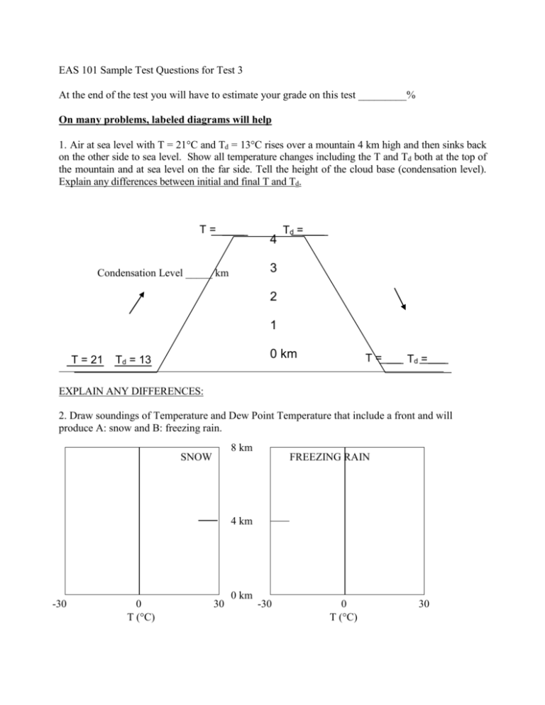
EAS 101 Sample Test Questions for Test 3 At the end of the test you will have to estimate your grade on this test _________% On many problems, labeled diagrams will help 1. Air at sea level with T = 21C and Td = 13C rises over a mountain 4 km high and then sinks back on the other side to sea level. Show all temperature changes including the T and Td both at the top of the mountain and at sea level on the far side. Tell the height of the cloud base (condensation level). Explain any differences between initial and final T and Td. T= 4 Td = 3 Condensation Level _____ km 2 1 T = 21 0 km Td = 13 T= Td = EXPLAIN ANY DIFFERENCES: 2. Draw soundings of Temperature and Dew Point Temperature that include a front and will produce A: snow and B: freezing rain. 8 km SNOW FREEZING RAIN 4 km -30 0 T (C) 30 0 km -30 0 T (C) 30 3. Fill in the missing temperatures in the diagram below of a warm front and then tell the form of precipitation at each point and give reasons. 4. Describe how hailstones form and the weather conditions they form in. Then describe the conditions that lead to clear ice and cloudy ice in the hailstones and briefly explain. 5. Name four forces on the winds and describe their effect. 6. Explain why the sky does not fall – how air can remain still when gravity pulls all objects including air downward. 996 L 7. On the weather map to the right, pressure decreases towards the _____. Then the geostrophic wind blows from the ______ 1000 and the wind near the ground blows from the _____ 8. On that diagram, show the wind direction. Draw forces for the geostrophic wind and for the wind near ground level. 1004 9. Temperature is 32C at ground level and 34C 1 km up and H the air is saturated. Prove if this situation stable or unstable. Then state whether thunderstorms or air pollution is more likely. 10. In the diagrams to the right, draw the winds, temperatures and locations and types of clouds along the shoreline on clear days and nights. 11. In the diagrams below, draw the temperatures, winds and locations Sea Land Sea Land and types of clouds in mountainous regions on clear days and nights. 12. On the map of the United States, draw the plan (map) view of an extratropical low showing fronts, winds, temperature, clouds and weather types. In the box below it, draw the panoramic (cross section) view of the low with fronts, winds, etc. 13. Describe the weather sequence when a low pressure area center passes by to your south. 14. Describe the typical life cycle of an air mass thunderstorm. 15. Draw a weather map of the USA showing the wind, temperature and humidity conditions that lead to severe, thunderstorms. 16. List the factors that lead to coastal flooding during a hurricane or intense low and explain briefly how they work. 17. Draw a plan view and cross section view of the structure of a severe, supercell thunderstorm showing locations of hail, rain, and tornado. 18. Describe the development process of a hurricane (i. e., typhoon) and list the necessary conditions for its formation. 19. On a world map outline the region in which typhoons form in the western North Pacific Ocean. Show with arrows the typical storm tracks and list the months they are most frequent. 20. Describe and explain the ways that hurricanes affect sea level. 21. In the infrared satellite image, label the eye of the hurricane “E” and the coldest clouds, “C”. The temperature of the land at point A = _____C, the water at point B = ____C and the coldest clouds of the hurricane = _____C. Is this an early morning or late afternoon image? Justify your answer. 22. Draw the front on the accompanying surface weather map. H H L H A B
