Sea Level Rise in Rhode Island
advertisement

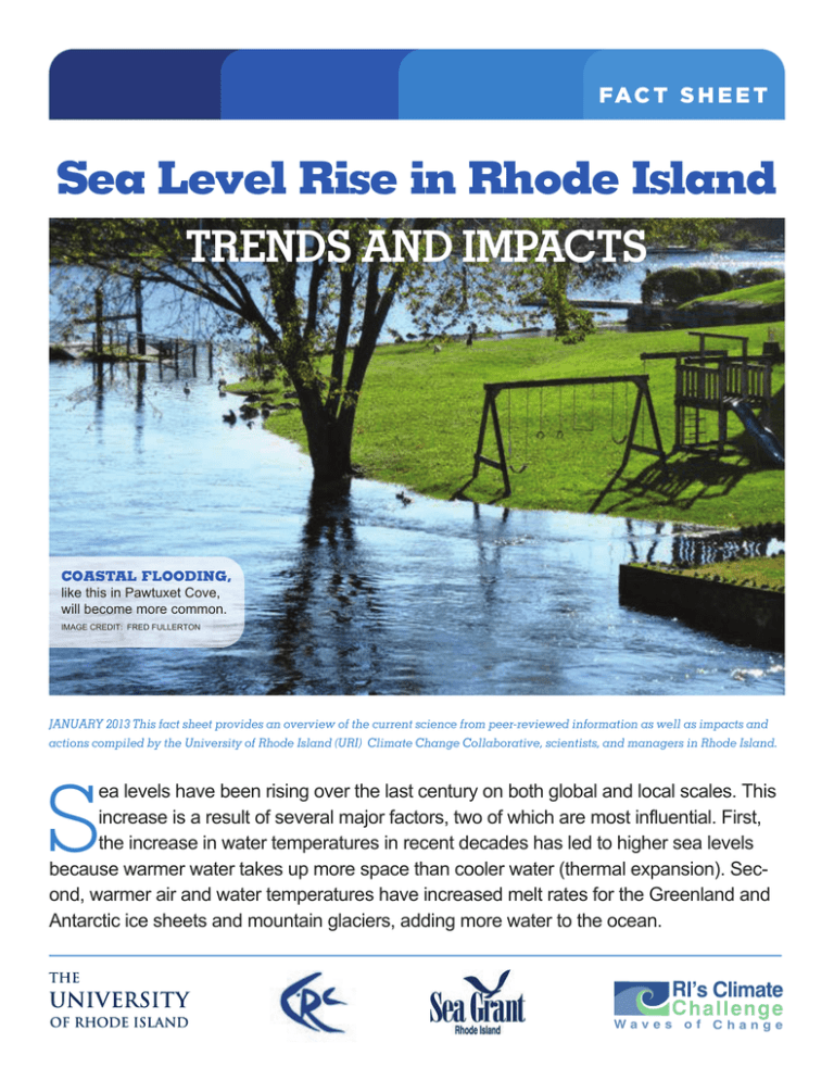
FA C T S H E E T Sea Level Rise in Rhode Island TRENDS AND IMPACTS COASTAL FLOODING, like this in Pawtuxet Cove, will become more common. ImAGe CredIT: Fred FullerTon JANUARY 2013 This fact sheet provides an overview of the current science from peer-reviewed information as well as impacts and actions compiled by the University of Rhode Island (URI) Climate Change Collaborative, scientists, and managers in Rhode Island. ea levels have been rising over the last century on both global and local scales. This increase is a result of several major factors, two of which are most influential. First, the increase in water temperatures in recent decades has led to higher sea levels because warmer water takes up more space than cooler water (thermal expansion). Second, warmer air and water temperatures have increased melt rates for the Greenland and Antarctic ice sheets and mountain glaciers, adding more water to the ocean. S RI’s Climate Challenge Waves of Change FLOODING IN WICKFORD during post-tropical storm Sandy of 2012, Wickford had over three feet of storm surge. CredIT: melISSA devIne SEA LEVEL RISE FACTS + Average global sea level has increased by 7 inches since 1900, which threatens low-lying coastal communities. + Since 1930, sea level in rhode Island has increased by an average of 1 inch per decade. + over the past half century, sea levels in the northeast have been increasing 3 to 4 times faster than the global average rate, resulting in a 6-inch rise between 1970 and 2012. + With accelerating rates, sea level is projected to increase by 3 to 5 feet above 1990 levels in rhode Island by 2100, with a potential for 1 foot of sea level rise by 2050. STORM TIDES AND SEA LEVEL RISE + A storm tide is the increase in water level generated by a storm combined with the influence of astronomical tides. + Increased activity of extratropical storms (nor’easters) on top of an already higher sea level will increase coastal flooding and erosion. difference between mean sea level at newport, r.I., from 1983 to 2001 and mean annual sea level plotted for each year between 1930 and 2012. The blue trend line shows a 8.7 inch rise through 2012, which is equalto a 10.6 inch (26.9 cm) increase in sea level per century. GrAPh CourTeSy oF Jon BooThroyd, 2012. SEA LEVEL RISE IN RHODE ISLAND - TRENDS AND IMPACTS + In some areas of the northeast, storm surges associated with future hurricanes could be 2 to 4 feet higher than present conditions. + damaging storm surges and higher tides in the northeast are predicted to occur more frequently in the future. evidence shows this is happening already. TAKING ACTION: FA C T S H E E T + new Shoreham is evaluating the potential impacts of sea level rise on ferry terminal operations and access to Block Island. + north Kingstown is identifying impacts, actions and infrastructure retrofits to adapt to rising seas, with the goal of targeting funding and integration to its comprehensive plan; this provides a template for Statewide Planning Program guidance available for other communities. + Bristol is looking at alternatives to critical road access impacted by storms. + Government and non-government organizations are monitoring saltmarsh impacts of sea level rise and evaluating alternative shoreline protection techniques to determine how best to protect future salt marsh and valuable ecosystem services. + Statewide maps are available depicting sea level rise inundation scenarios of 1, 3, and 5 feet and the 1938 hurricane http://seagrant.gso.uri.edu/climate/slr_tools.html The URI Climate Change Collaborative is an interdisciplinary project funded by Rhode Island Sea Grant that draws on communication and behavioral science as well as climate change research to promote adaptation to sea level rise and the impacts of climate change. Learn more at seagrant.gso.uri.edu/climate. BEACH EROSION like the edge of a sand castle at high tide, shorelines will be more vulnerable to flooding and erosion. ImAGe CredIT: PAm ruBInoFF FA C T S H E E T SEA LEVEL RISE IN RHODE ISLAND - TRENDS AND IMPACTS SEA LEVEL RISE IMPACTS COMMUNITIES BY INUNDATING LOW-LYING COASTAL AREAS AND INCREASING RISKS FROM STORM TIDES. BUILT ENVIRONMENT: + Structures and roads will need to be raised or relocated above increasing coastal flood elevations. There are already locations where roads flood during extreme high tides. + Causeways, such as the Galilee escape road, or bridge approaches in low-lying areas will need to be elevated. + An estimated 2,700 housing units are within an elevation of one meter (3.3 feet) above sea level in rhode Island. residential and business properties in low-lying areas will likely be inundated permanently or during more frequent extreme high tides. + Ten at-risk coastal wastewater treatment facilities will need to be evaluated to determine risk, and options to reduce damage and disruption to service; other sectors with critical coastal infrastructure such as port facilities and energy and gas networks will also need to evaluate potential impacts and adaptation options. NATURAL RESOURCES: + rising sea level may drown salt marshes as rising tides outpace marsh growth, affecting their productivity and the fish and wildlife that depend on them. + Salt marshes seeking higher ground may not be able to migrate inland if they are constrained by hardened shorelines, elevated landforms, or coastal development. + Beaches will also migrate landward and if impeded by development will narrow or disappear altogether, reducing the area available for public recreation and tourism, and affecting habitats for plants and birds migrating or nesting on shore. PUBLIC HEALTH AND WELFARE: + drinking water systems will be impacted. Saltwater intrusion to groundwater may affect numerous homes with wells near the shore. + Coastal properties with septic systems will likely see reduced treatment of waste, and potential failure, with elevated groundwater and saltwater intrusion. This also may increase coastal pond contamination. + Increased flooding of coastal roads, evacuation routes, and bridges during high tides and storm surge events may leave coastal populations trapped with no means of accessing emergency services. For more information and detailed references, visit Rhode Island Sea Grant’s page on climate change at http://seagrant.gso.uri.edu/climate/


